|
|
|
|
|
|
|

|
||||||||||||||||||||||||||||||||||
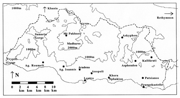
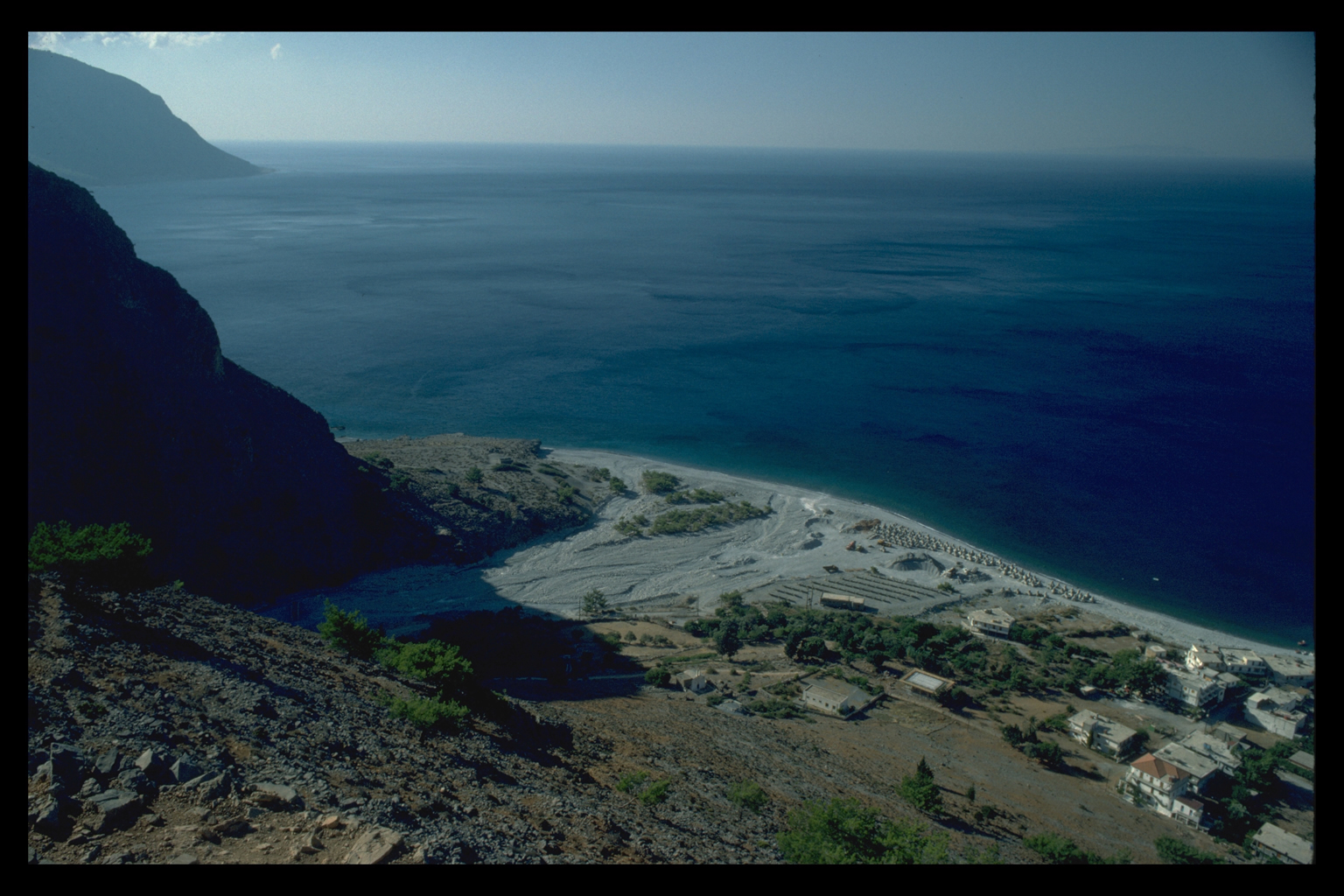
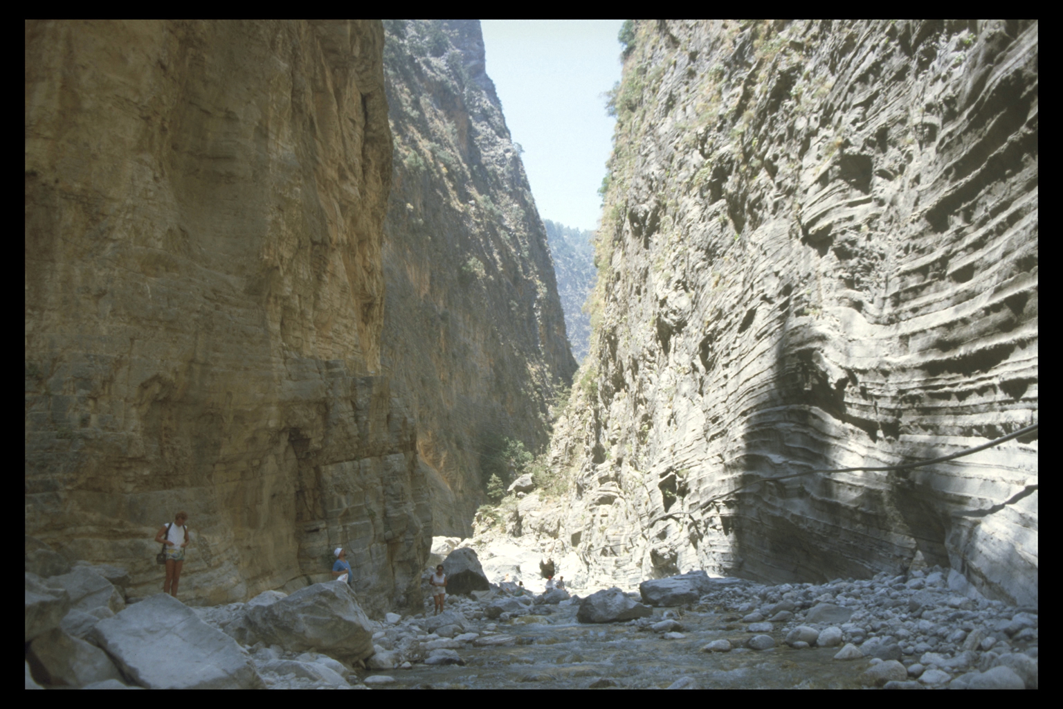
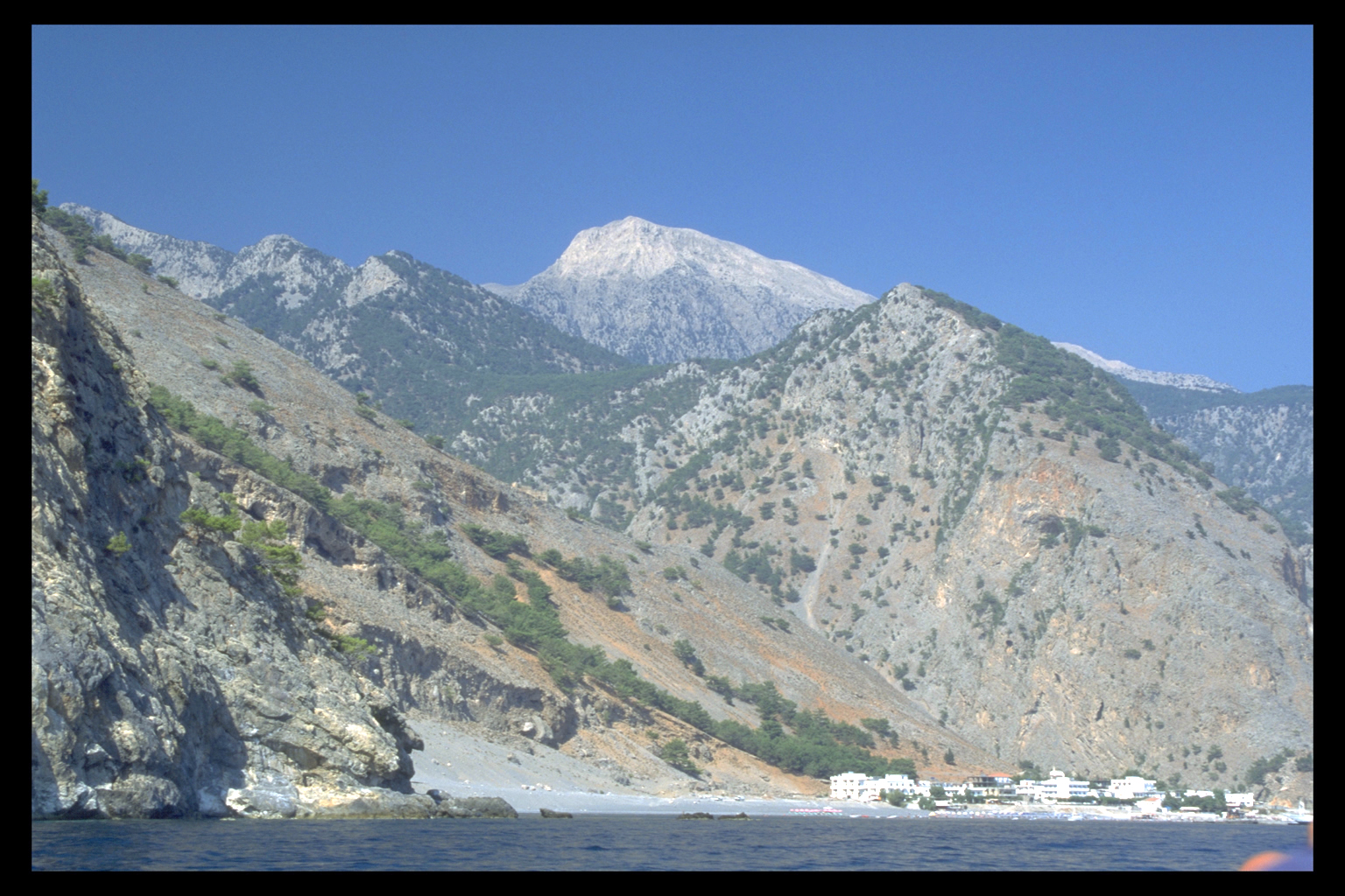
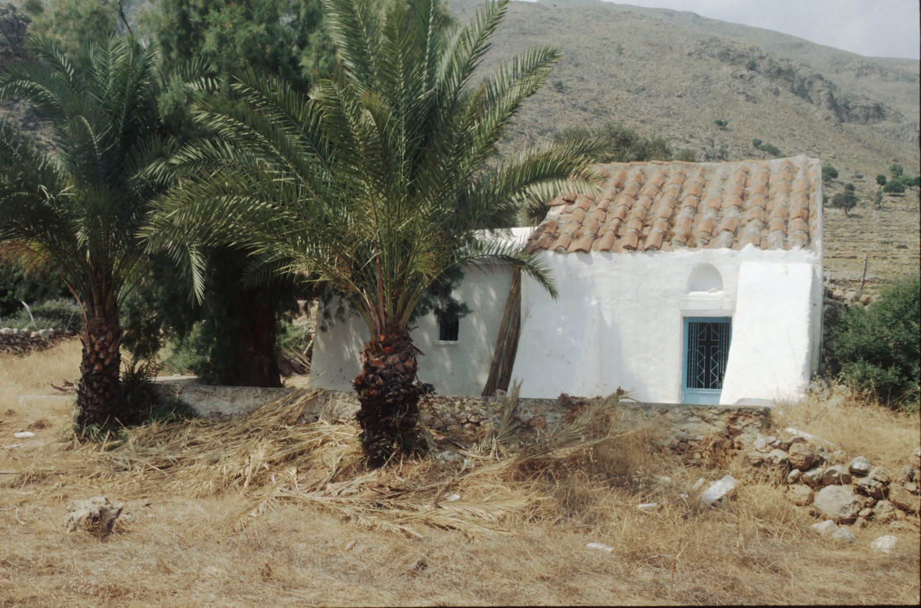
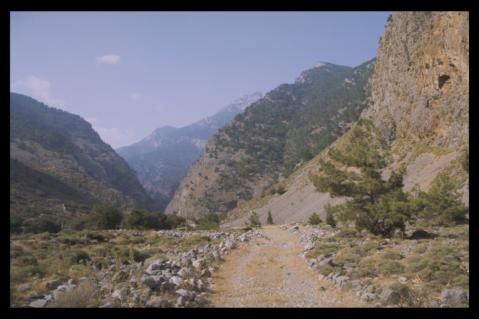
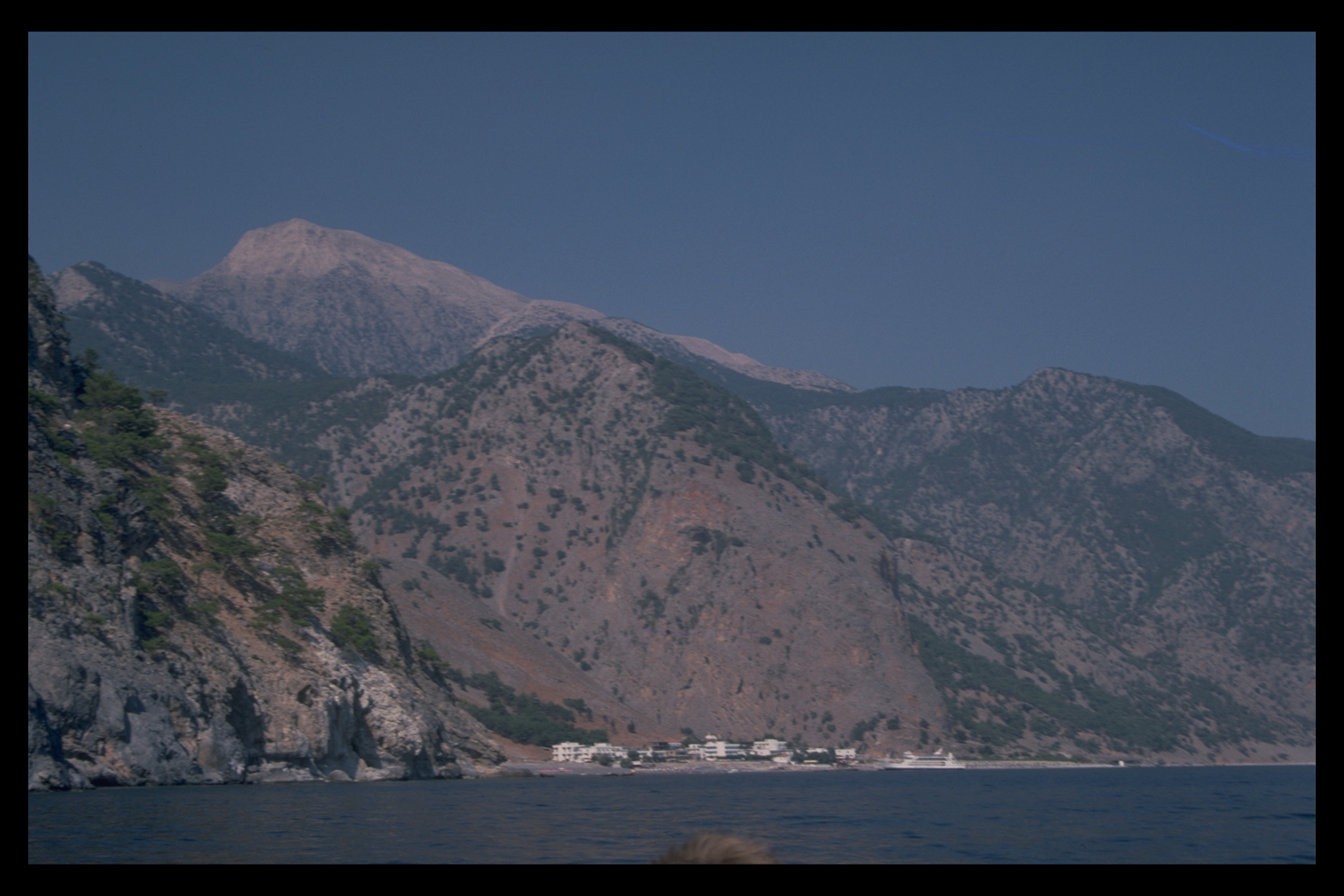
ARCHAEOLOGICAL SURVEY IN SPHAKIA, CRETEL. Nixon, J. Moody, and O. Rackham, Echos du Monde Classique/Classical Views 32, n.s. 7 (1988), 159-73 We are most grateful to the Editor of Echos du Monde Classique/Classical Views for permission to reproduce this article here INTRODUCTION The eparchy of Sphakia is a rugged and in some ways remote area. It includes most of the White Mountains - whose highest point (Mt. Pakhnes) at 2452 m is only 16 km from the south coast - and at least 10 major gorges running down to the Libyan Sea. There is little arable land, although mountain plains such as Anopolis and Askyphou are cultivable. Only one road (to Khania) links Sphakia with the outside world, but a regular boat service still runs from Khora Sphakion to Loutro, Aghia Roumeli, and further west. Nowadays some villages in Sphakia (pop. ca. 3000) continue to live by farming and sheep-herding; others have been deserted; still others have been revitalised by tourism (200,000 people hike the Samaria Gorge every year).
It is not possible to understand Sphakia without some understanding of the landscape and how it has changed. But one look at today's uneasy mixture of tradition and tourism should dispel any notions of geographical determinism: Sphakia has not always been like this. Nonetheless, knowledge of how people live in Sphakia - current land use and transhumance, settlement patterns influenced by foreign preferences for sea and sun - has been valuable in forming research questions about the different ways people can (and possibly did) interact with the Sphakiote landscape. Previous researchThough Sphakia is well known historically as a stronghold of resistance against Venetians, Turks, and Germans, it has never attracted much archaeological attention. Over the last twenty years, however, it has become clear that western Crete, particularly the area around Khania on the north coast, was important in the prehistoric period as well as later 2. Sphakia provides an unusual opportunity for researchers studying the relations between human activities, vegetation, and the environment. It covers a large area (about 470 km2) with a broad environmental and altitudinal range (0-2400 m above sea level). The vegetation is of interest, because it includes many endemic species. The range of data for human activity in Sphakia is also unusually broad: historical data, often contained in travellers' accounts 3; anthropological research (e.g. that of Tumasonis, and more recently that of Damer in the plain of Askyphou); 4 and archaeological material.
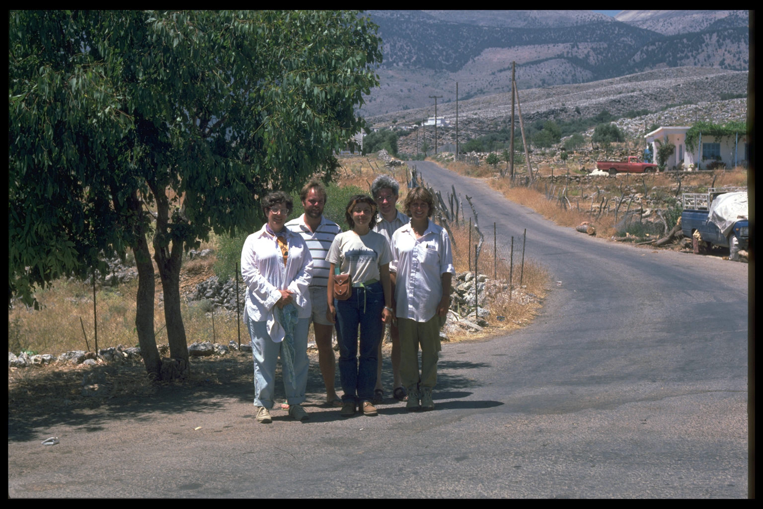
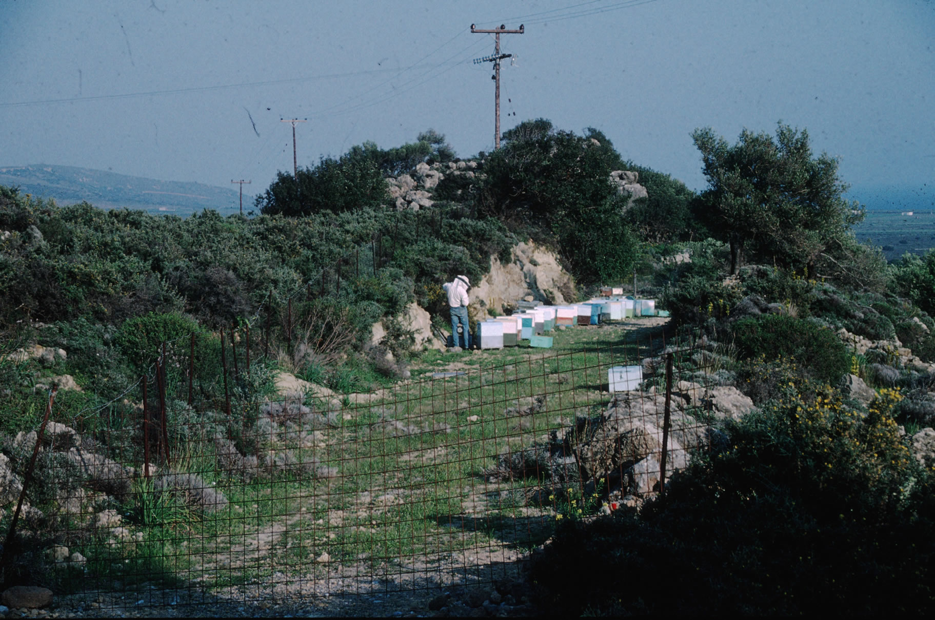
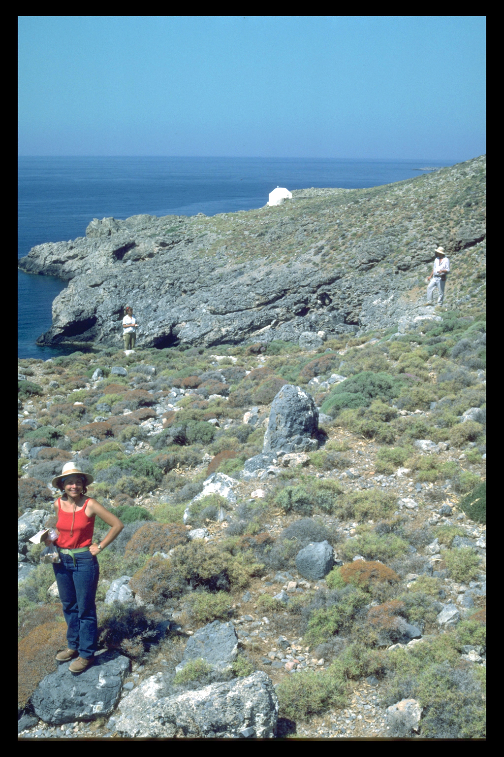
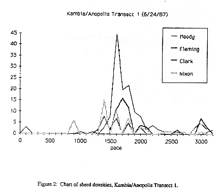
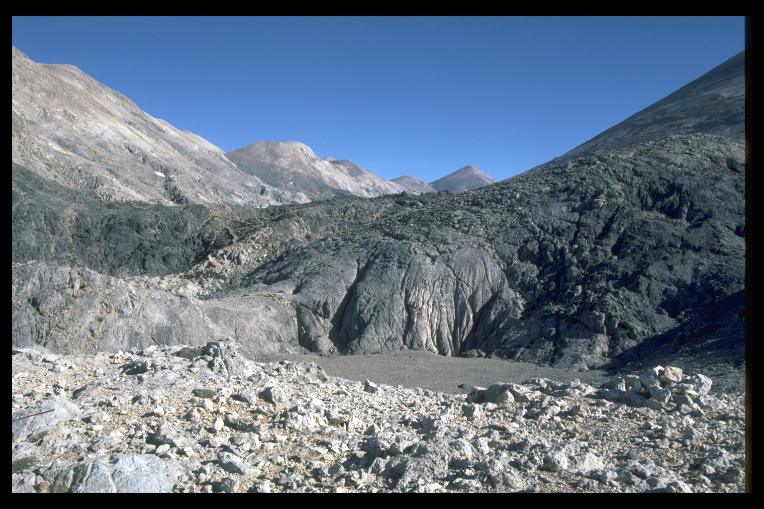
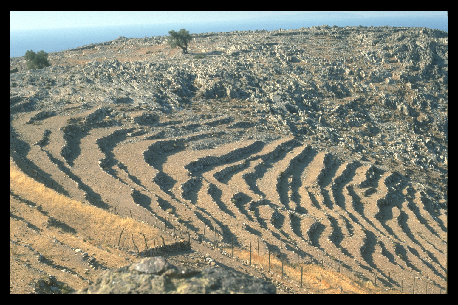
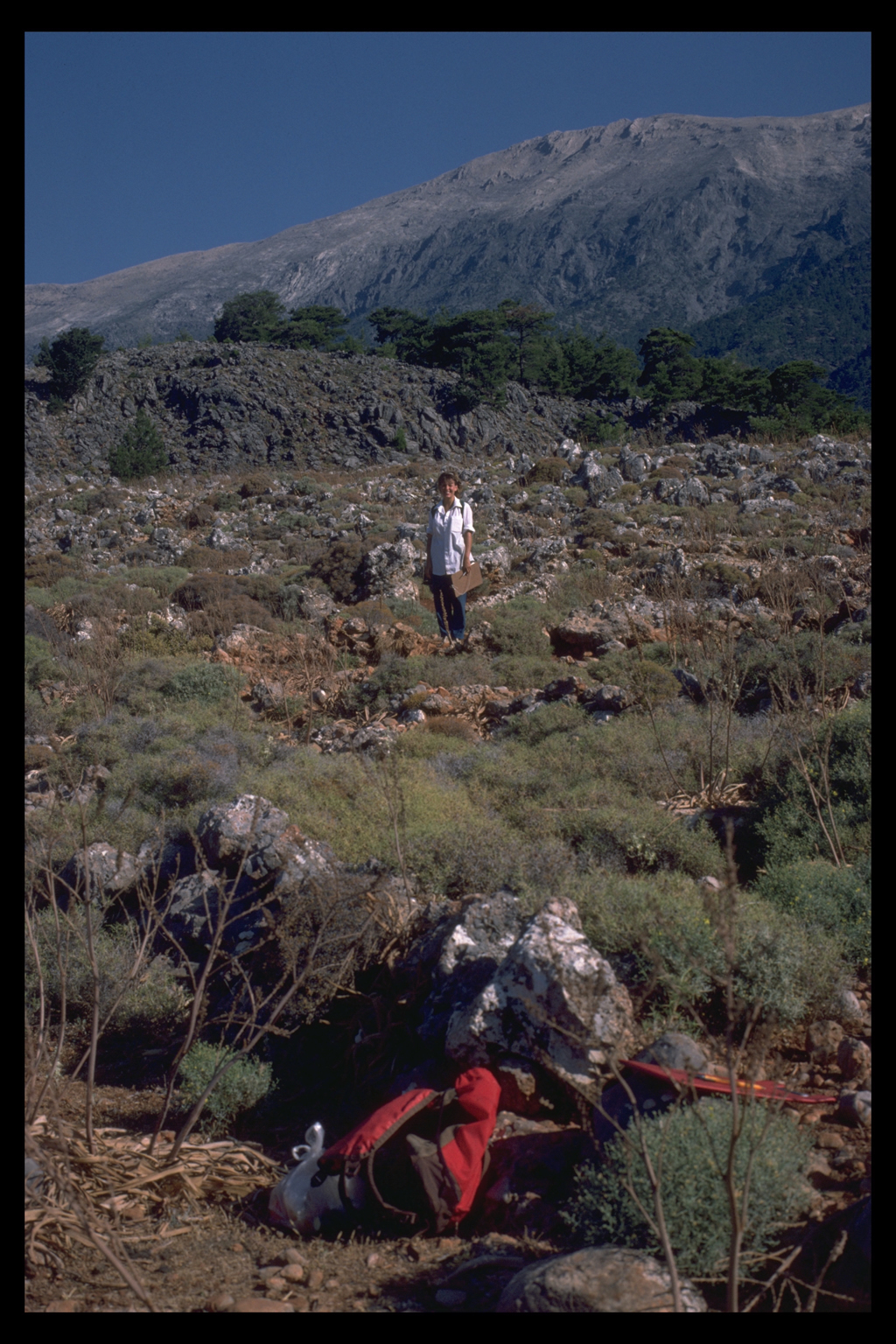
ObjectivesOur general objectives for the Sphakia Survey were investigation of the physical environment and the vegetation in the historic and prehistoric periods, the sequence of human activity in Sphakia, the relationships between coastal and inland settlements, and possible connections between Sphakia and areas to the north. Our specific goals this year were to collect data relevant to these objectives and to devise an effective sampling programme for future seasons. Our initial plan was to survey a relatively small area of some 65 km2. When our permit from the Greek Archaeological Survey came through, we discovered that we had been given permission to survey virtually the entire eparchy 9. One consequence of this generous seven-fold increase in size of our survey is that it now includes the Samaria Gorge, whose archaeological importance has already been mentioned. METHODS OF FIELDWORKAll fieldwork, whether archaeological or environmental, involves some kind of sampling; there are very few projects where an entire area has been investigated in great detail. The challenge in most cases is to get the sampling right, that is, to make sure that the parts investigated are representative enough of the whole. In the case of Sphakia we have considerable luxury of choice, with a study area of about 470 km2, or roughly 1/20 of Crete. This is unusual in Crete, where nearly all other surveys have worked in very small areas, but fairly typical of the rest of Greece and Italy, where larger survey areas are more common. The usual procedure for larger areas is to divide them into their constituent geographical regions, and then to use those regions as the basis for a stratified sample 10 Eight geographical regions This is, broadly speaking, the procedure we followed. Our original study area of 65 km2 was too large to be surveyed completely by walking; the increase in its size simply meant more choice in the selection of sample areas, as stated above. Our work this summer has led us to subdivide Sphakia for the present into eight geographical regions: 1. The coastal plain to the east of Khora Sphakion: an arid plain no longer cultivated, although it has been in the past. 2. The foothills up to about 800 m, including all the surviving villages (except those of the mountain plains), where some terrace-cultivation and olive-growing still persist. 3. The middle slopes, 800-1200 m, which are less arid but seldom have much soil. These are now either woodland or pasture, but have often been cultivated in the past. There are a few deserted villages. 4. The upper slopes, 1200-1700 m which are now mainly woodland (often grazed) and show little sign of ever having been anything else. 5. The mountain plains (Greek: oropedhia). These areas of flat land, in depressions high in the mountains, are a special feature of Crete. The famous Omalos Plain lies just outside our area. Within our bounds there are three such plains - the Anopolis, the Askyphou, and the Asphendou - with settlements and cultivation, and at least four more at higher altitudes. 6. Gorges and cliffs, which in west Sphakia cover most of the area. 7. The mountain desert of the high White Mountains, an astonishing landscape of glaciated rocks and sinkholes, quite barren of continuous vegetation, but with many rare and eccentric plants. 8. The Madhares, the northern half of the White Mountains, a lower and slightly less arid region, though still too high (1700-2000 m) for tree growth or cultivation. Every one of these regions is now used by the inhabitants in some way, except for the Mountain Desert. The Madhares, for example, are used as summer pastures for up to 5000 sheep and goats; sheep's milk cheese is still made there in the corbelled stone structures known as mitata. The Upper Slopes and Gorges are browsed; they also yield honey and a little timber and fuel. Permanent settlement, however, is confined to areas below 800 m - the Coastal Plain, the Foothills, the Middle Slopes, and until recently, a few Gorges. For more details see the Environmental section of the site. These eight regions form the basis of our sampling strategy. Different regions require different sampling procedures, because of terrain and vegetation, and therefore potential for human exploitation; so the method and degree of sampling will vary from region to region. For example, highly intensive sampling (up to 100%) is appropriate to the coastal plains because they will probably always have provided the best land for settlements; while a purposeful non-random sample (10%) in the Madhares will enable us to visit mitata and water sources in order to investigate the use of the area in the past (transhumance? connecting routes to the north coast?). This year all eight regions were partially sampled, but lower altitude areas received more intensive coverage. Land use In modern Sphakia, then, we have the paradoxical combination of a restricted settlement base and wide-ranging land use of various kinds. This information has already helped us to work out our sampling strategy for next year, when we can begin to see whether such contrasts existed in the past, or whether other patterns prevailed. Thus our modern data have already suggested several questions for us to address in reconstructing the sequence of human activity in Sphakia, and it will obviously be worthwhile for us to continue to collect relevant anthropological information. ARCHAEOLOGICAL SURVEYThe archaeological aim of this pilot study was not so much to identify individual "sites" as to determine the chronological range of human activity and its distribution within the eight environmental zones. We used two methods of exploration: first, extensive investigation of a selected area by car and on foot. This involved driving down every passable road or track, checking roadcuts and scarps for environmental and archaeological information, and visiting any known sites, chapels, or other points of interest. The second involved the more intensive investigation of smaller areas by the systematic walking of transects. Four people (Nixon, Moody, Clark, and Fleming) walked in parallel, 10 to 15 m apart; the person with the longest pace kept a pace count. Recording The 100 paces (about 77 m) used this year as a test interval seems to be too large. The same 100 pace interval was used successfully by Moody and Dr. Barbara Hayden in a survey at Vrokastro (East Crete) where evidence of past human activity was thicker on the ground. The most efficient sampling interval may be related inversely to the intensity of human activity: the less intensive human activity was, the smaller the sampling interval must be to recover it. In any case, surface survey methods must be adapted to the region being studied. During our five-week field season we checked several locations where archaeological material had already been found 11. In every case we noted whether the material was more or less abundant than on previous visits, and whether a greater chronological range and type of material was visible. We also investigated 29 different areas in the extensive manner described first, and completed 35 systematic transects. The next stage was to plot all the densities of sherds found by the four parallel walkers as superimposed graphs and then to compare them with the figures recorded along the entire length of each transect. This procedure will help us to identify areas for future work and to determine the best sampling interval for areas where this method is appropriate.
HISTORICAL ECOLOGYIt is also our object to reconstruct the physical environment of Sphakia - the geology, climate, and soils - and the activities of plants and animals in the past. In part this will provide a background to historic and prehistoric human activities, but it is also an objective in itself, and our time-scale is not limited by the beginnings of human settlement on Crete. Since the area of archaeological survey is exceptionally large and varied, it should be possible (unusual for such surveys to collect all the necessary information on vegetation and the environment without going beyond its boundaries. Historical ecology involves the following methods: (a) study of the present vegetation, including tree rings, the preferences of browsing animals, and the vegetation of cliffs which, to some extent, has escaped browsing, burning and woodcutting; (b) field recording of features such as terraces and field-walls; (c) examination of written records; (d) analysis or archaeological finds, such as the timbers of ancient buildings; (e) the study of soil and sediment profiles, and of the pollen and other plant remains preserved in them. We have made use of all of these techniques in Sphakia. In 1987 we took a number of soil cores for particle size analysis and study of the fossil plant remains (phytoliths) 12. We have also begun to analyse the satellite image purchased earlier for further information about the ecology of Sphakia. PRELIMINARY RESULTS: HISTORICAL ECOLOGY
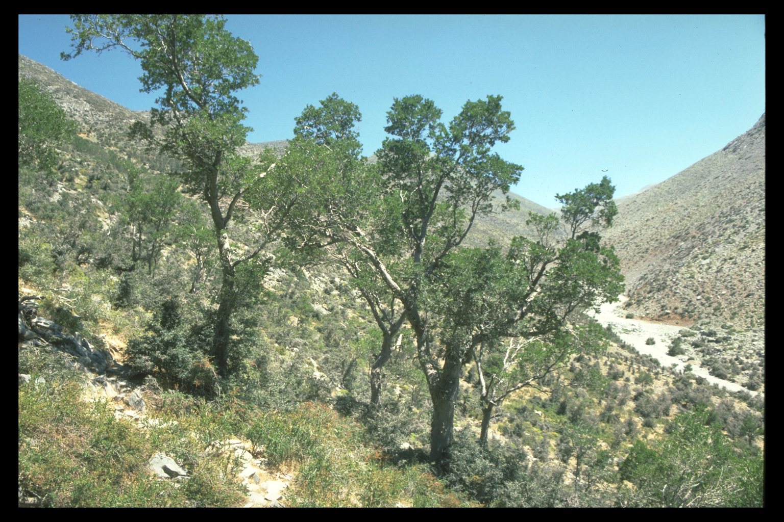
The remaining soils are somewhat more erodible than is usual in Crete. As we have recently found elsewhere in the island, erosion has little to do wth the presence or absence of trees, but depends largely on the absence of the crusts that hold the landscape together. These crusts are usually composed of tiny plants: mosses, lichens, blue-green algae. In Sphakia they are poorly formed, perhaps because of the dryness, and are easily destroyed either by cultivation or by goats treading on them or overturning stones. There are at present (despite the shrunken human population) enough goats to prevent the crusting of large areas. The exposed soil, if red, is slowly washed downslope by rain; if yellow, it is blown away by wind, by the same process that originally brought it. Cultivation
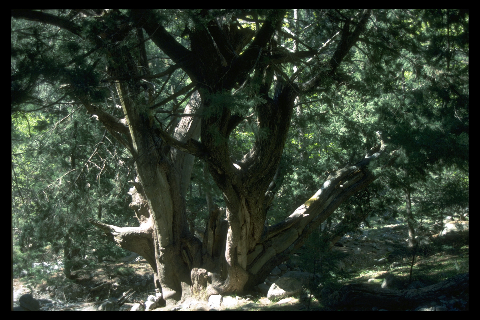
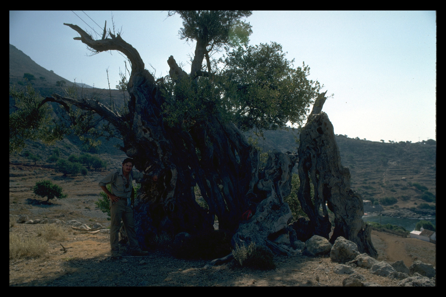
Trees
There has been a dramatic increase of trees in the last 200 years. We
have begun to document this change by studying the sizes and annual rings
of existing trees, by searching for stumps and dead trees, and by comparing
illustrations in travellers' accounts and early photographs with what
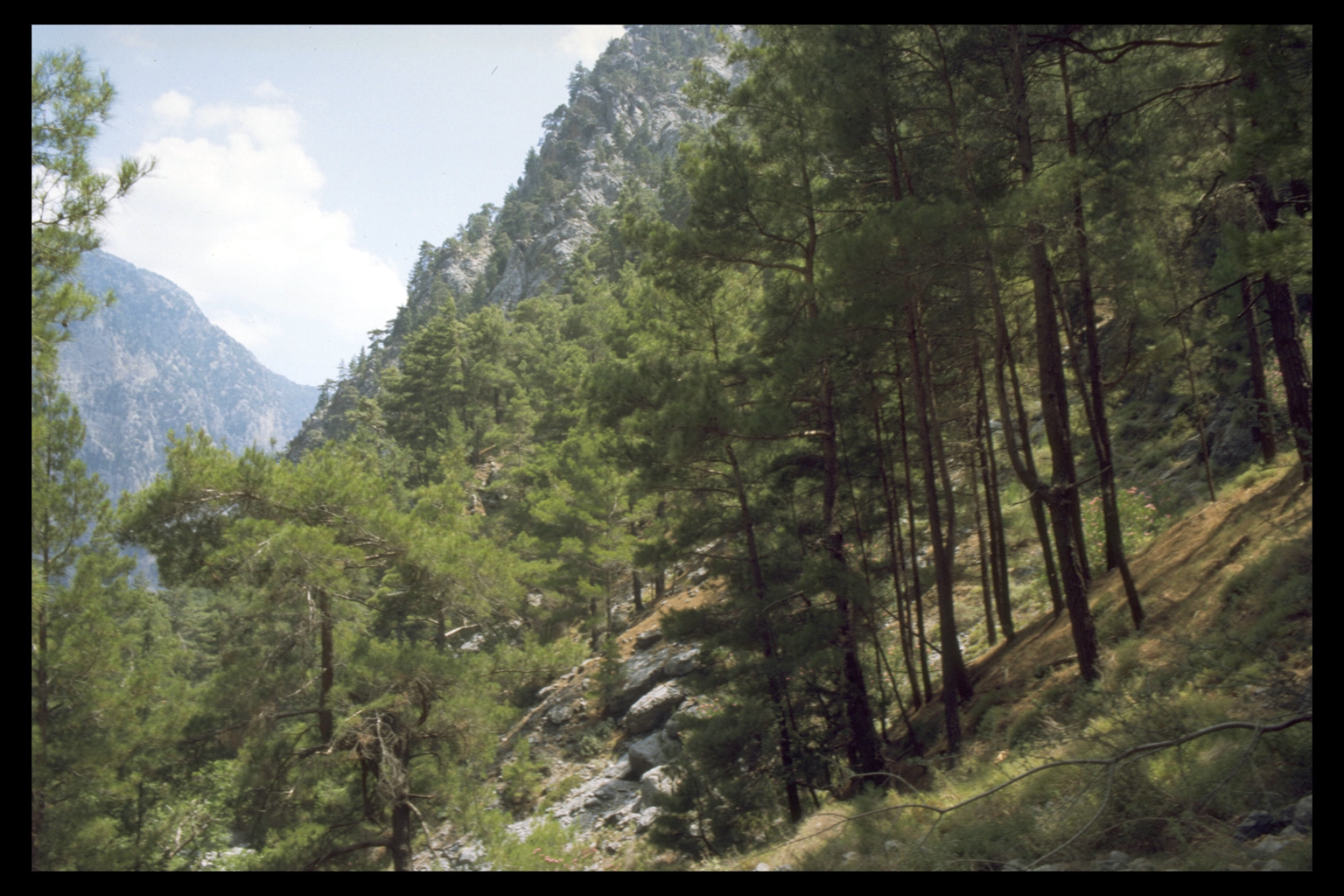
is there now. Most of this increase has occurred on the middle, and to some extent the lower, slopes, on former pasture or cultivation. Trees have undoubtedly advanced towards the sea; we do not yet know whether this is due to changes in climate or in browsing. The upper altitudinal limit of trees is stable, consisting usually of small, ancient cypresses: it is set by wind-exposure and cold. Pine, which is now dominant over large areas, was probably rare until the nineteenth century; it may even be a newcomer to the region. It rarely occurs in travellers' accounts or place-names and is uncommon as a building timber. We have never found a pine of more than middle age. The increase in the frequency of pine creates a fire risk, as demonstrated in the Hierapetra area of east Crete. We found one pine that had indeed been set on fire by lightning.
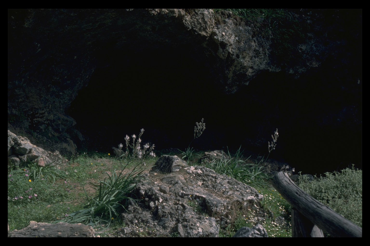
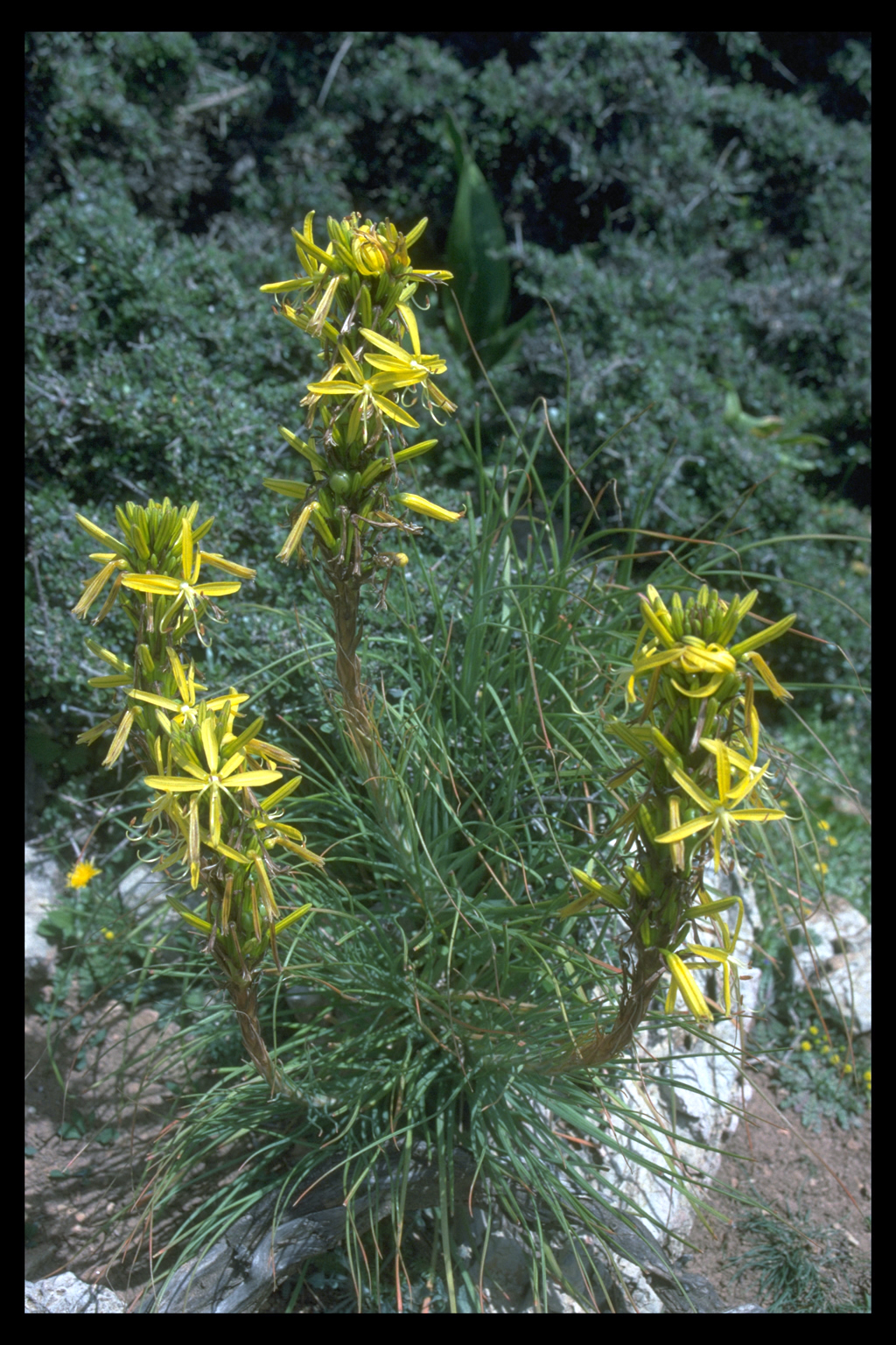
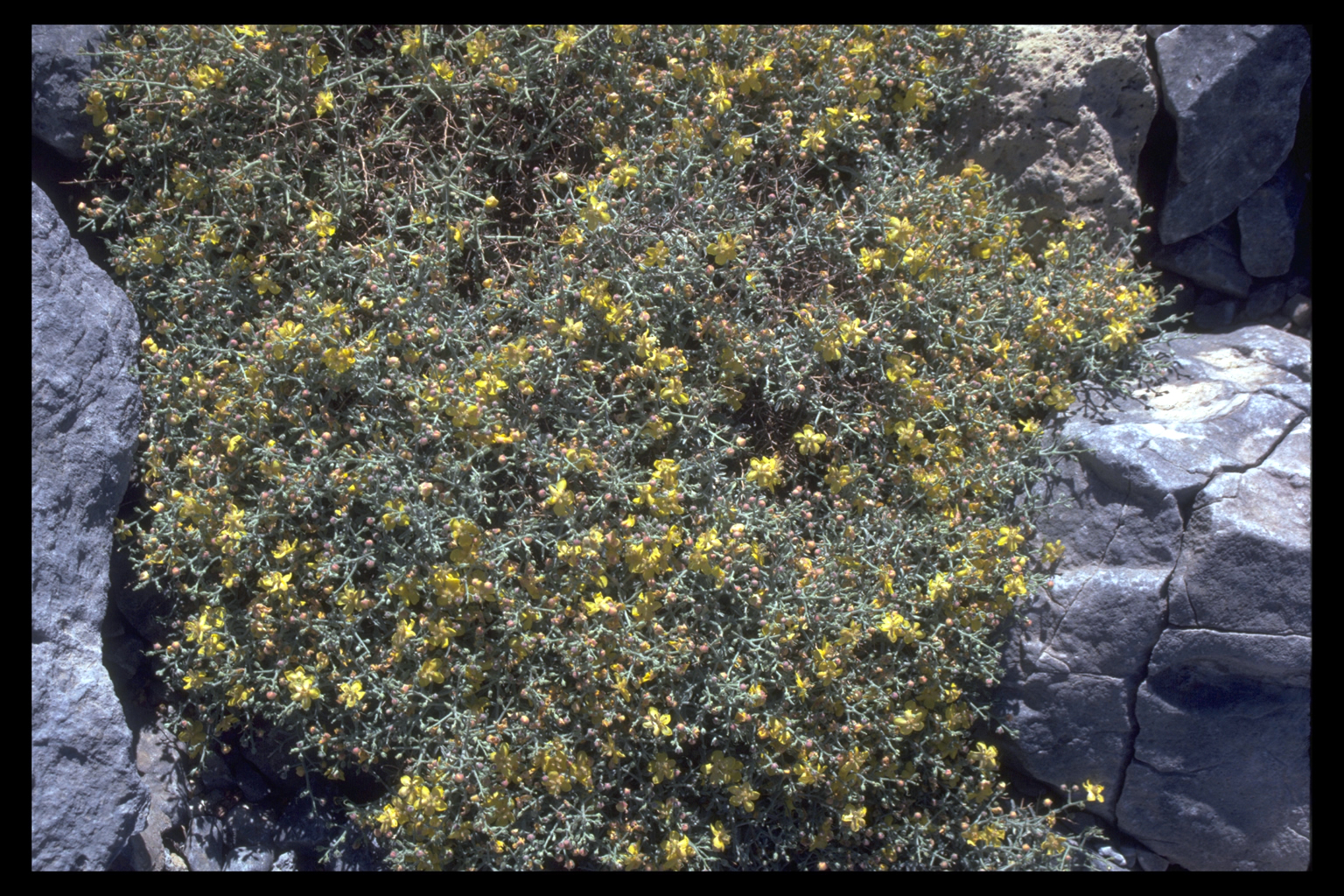
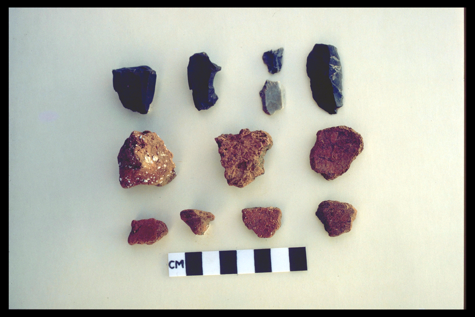
We have begun to estimate the potential natural vegetation by the study of gorges, which contain relict plant communities from earlier periods in the region's history. For example, this approach resolves the question of whether the treelessness of most of the seaward slopes is due to browsing. If it were, we would expect to find trees in the lower Aradhena and Imbros Gorges, in places which goats cannot reach. We do not, and infer that climate - lack of moisture - must be involved. Endemics PRELIMINARY ARCHAEOLOGICAL RESULTSThe season's results have been gratifying. Materials ranging in date from possible Mesolithic to Turkish have been recovered, indicating that Sphakia has probably been continuously inhabited since the beginning of the island's human history. Our archaeological observations are based primarily on pottery, though walls and sometimes standing remains survive (e.g. Loutro/Phoinix). The usual problems of recognition and dating apply here: that is, the pottery is more easily recognisable for some periods than for others. In Sphakia, as in western Crete generally, decorated fine wares do not survive well, and chronology must therefore rest on coarse wares 14. The details of the chronology will be carefully worked out when more material has been collected and after the systematic study of coarse ware deposits from relevant locations has been completed. We hope then to recognise pottery dating to periods such as Geometric and Archaic that now elude us completely. In the meantime it is worth noting that most sherds are datable to the three broad categories discussed below. The second most common material recovered is chipped stone. Most of the stone tools found are made of the locally abundant black chert. Obsidian tools occur, though not nearly as often, and their presence at an early date (see below) in a supposedly remote area is of great interest. For the purposes of this preliminary report, the archaeological results have been grouped into three broad periods, 1. prehistoric (everything down to 1000 B.C.); 2. historic (shorthand for the Greek, Roman, first Byzantine and Arab periods on Crete, i.e. 1000 B.C. - A.C. 962); and 3. medieval/modern (A.C. 962-1900). PrehistoricAs stated above, part of the appeal of Sphakia as a study area was its potential for prehistoric sites. We re-examined the possible Mesolithic site in the Samaria Gorge, first identified by Mortensen in 1982. It consists of an assemblage of small stone tools made of the local tabular grey chert and of debitage from their production. The artifacts are scattered over a low spur on the west side of the gorge and in a rock shelter. No associated bone was seen. Mortensen now dates this material as Epipalaeolithic, but even as Mesolithic, it would be the earliest evidence for the human exploitation or habitation of Crete. There is other evidence that may suggest the occupation of Crete before the Neolithic period - black chert implements from a location near Timios Stavros (between Khora Sphakion and Loutro).
The rest of the prehistoric material consists of Middle Minoan-Late Minoan I sherds. Middle Minoan III-Late Minoan I pottery was found for the first time in the Samaria Gorge, and a possible prehistoric sherd was noted at Livadha in the Madhares. No clear Late MInoan III material was found, despite the three vases purchased by Evans, which have already been mentioned. Again, this may be a problem of visibility or recognition. Generally speaking, the presence of prehistoric sherds in nearly every part of Sphakia suggests extensive, not intensive, exploitation of the entire area during this period, rather than partial development along the coast as might have been inferred from earlier research. We have identified a total of 17 new locations with prehistoric material (Final Neolithic-Late Minoan I) that would repay more detailed investigation. Graeco-RomanSo far we have not recognised any sherds dating from Protogeometric to Archaic. Diagnostic classical sherds are so rare that nearly all our historic material has been lumped as Hellenistic/Roman (HR). Possible HR sherds were recorded at Livadha in the Madhares. Their presence could suggest either a route through the White Mountains, or the use of the area as summer pasturage. HR pottery was recovered from a number of other new locations, in addition to known sites such as Loutro/Phoinix, and Frangokastello.
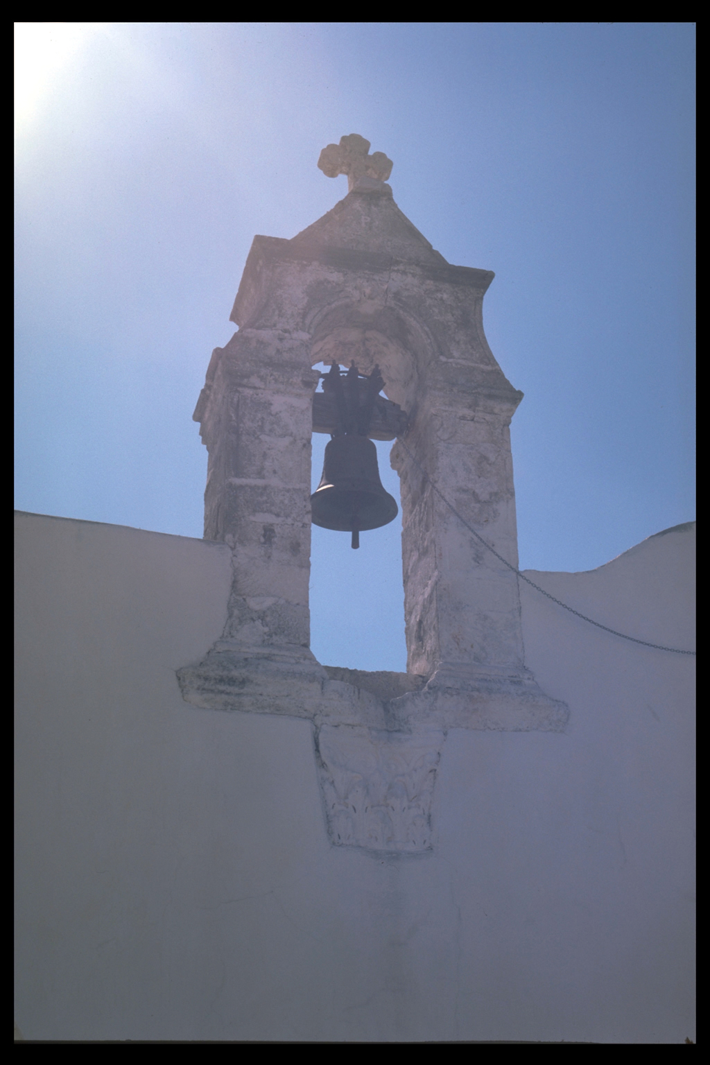
There is no doubt that this is another period of extensive use of the area, if not of actual prosperity. There were four bishoprics in southwestern Crete in the first Byzantine period (two in the adjacent eparchy of Selinon, two in Sphakia): the construction of several basilicas confirms the early importance of Christianity in Sphakia itself 15. Venetian-TurkishEvidence for the medieval/modern period consists of structures such as houses and churches as well as pottery. Some types of pottery, such as Byzantine/Venetian sgraffito ware and Turkish yellow/green dribble ware, are very distinctive; others less so. Little work other than description has been done on vernacular architecture, so that houses are not closely datable; nor is the chronology of Sphakiote churches fully understood 16.
CONCLUSIONSOur pilot season has enabled us to refine our long-term objectives for the Sphakia Survey. First, we need to learn more about the environment and vegetation of Sphakia, both before and after people arrived on Crete. Thus our investigation will include work on the ecological behaviour of the specialised endemic plants that evolved in the Pleistocene period, and the effects of possible glaciation in the White Mountains. Second, we would like to answer the question of when people arrived in Crete. As mentioned above, the current view is that they came in the Neolithic period, but possible Mesolithic tools have been found in the Samaria Gorge. The excavation of trial trenches at this site would help us to date and describe what could be an earlier phase of human occupation on Crete 17. Third, we hope to shed light on the Minoan period in western Crete. Twenty years of research have shown that Khania on the north coast was a dynamic cultural centre throughout the Bronze Age. How were Sphakia and the Khania area connected? Were they linked by paths over the White Mountains? We hope to answer these questions by investigating the mountain routes still used by Cretan shepherds. Fourth, the stronghold effect and inland-coastal relationships are of continued interest to the project. Sphakia is said to have functioned as a stronghold to which people could retreat from outside invaders. In some periods, stronghold inhabitants might have wanted to avoid contact with the coast; in others, a strong coastal link could have been an advantage. What determines inland-coastal fluctuations in settlement - internal or external factors? How does coastal linking affect the growth and development of settlements and the connections between them? These questions are relevant to the full chronological range of the survey. We look forward to continuing our work in Sphakia in future years, in the hope that our research on the ancient and modern settlement patterns of Sphakia, as well as its landforms and historical ecology, will be useful both to those who study the past, and to those who plan for the future of this part of Crete. LUCIA NIXON, QUEEN'S UNIVERSITY AT KINGSTON/ CANADIAN RESEARCH INSTITUTE FOR THE ADVANCEMENT OF WOMEN JENNIFER MOODY, UNIVERSITY OF MINNESOTA OLIVER RACKHAM, CORPUS CHRISTI COLLEGE, UNIVERSITY OF CAMBRIDGE FOOTNOTES
|
|||||||||||||||||||||||||||||||||||
©
The Sphakia Survey: Internet Edition, University of Oxford 2000
Designed and Developed by ACDT
at University of Oxford
This page last updated